 New data is now available in FiberLocator!
For a limited time, FiberLocator Online users can choose to view submarine cable operators and landing stations along with all the other great telecom data in the system. If you have any questions about the data or how to use it, don’t hesitate to contact us.
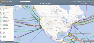
Take the new submarine cable data for a spin and see how it renders on the normal FiberLocator map view. You’ll notice the data shows very much like the terrestrial networks in FiberLocator, with colored lines and circular icons to represent landing stations.
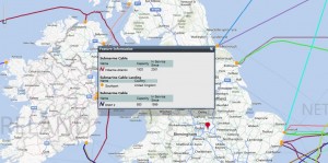
 Also, as with other data sets represented in FiberLocator, you can use the “Get Info” tool in the main toolbar to click on a map element and get more detail on the feature. The data encompasses the carrier name as well as the capacity and the date that the cable was put in service. What’s more, when viewing the details on the landing stations, you’ll see the name and country of the landing station along with all the carriers present there.
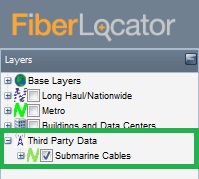
In addition to the built in data sets (metro and long-haul networks, on-net buildings, and data centers/colo providers), you can access undersea cable providers and where they connect by selecting the “Third Party Data” option in the layer tree and clicking the check box for the “Submarine Cables” option. As with all the data sets in the  layer tree, you can select the “+” icon to the left of the layer name to expand that section to choose only certain providers or options.
Tell us what you think of the submarine data. Is it helpful in your day to day research and analysis? How often do you access this information? Are their other data sets you would find useful as well? Your feedback is vital to ensuring FiberLocator remains the most useful and comprehensive resource for telecom GIS data. Please take a moment to share your thoughts on FiberLocator today!


