


New API Enhancement to Provide Greater Geospatial Analysis
Recently, the FiberLocator team upgraded its API to allow for more sophisticated analysis and control at the critical last mile of connectivity. With this latest addition to the application programming interface (API), members now can retrieve GeoJSON objects.
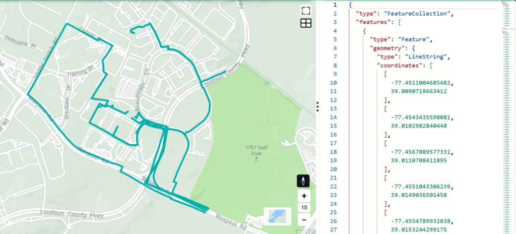
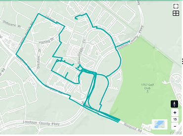
Putting it in more technical terms, this add on upgrade to the FiberLocator platform enables GeoJSON objects to be utilized in any GIS software to allow for various mapping and geospatial analyses, meaning customers will now be able to have the option of retrieving a GeoJSON FeatureCollection (list of network lines) over a small area based on a latitude and longitude for a specific radius or around a single address for a specified radius.
So Why Is It Important?
This will now allow API customers to gain a greater level of data to analyze and calculate more accurate distances. We are delivering the actual lines instead of a picture of the lines. Basically, with the “raw” information you can to do all sorts of analysis and manipulation in finding exactly where the fiber is within your GIS system.
Some examples:
- Calculate distances
- Include additional attributes
- Manipulate the lines
Would You Like More Info?
The team at FiberLocator is always happy to help and assist you! For more details and information on the latest update, please contact us at support@fiberlocator.com.