


In this post, our Vice President, Mike Iapalucci, adds to his previous post on using FiberLocator fiber location data as an input for evaluating locations for new data center construction. In this second installment, Mike looks at access to power.
Data Centers need Fiber and Power
When it comes to data center location selection, access to power, water, and fiber make up the holy trinity of selection criteria (on top of actual land availability). FiberLocator’s comprehensive database of fiber and on-net buildings is an excellent source for understanding the fiber proximity aspect of this trinity.
In addition to fiber connectivity, data centers of course require access to significant power to run installed servers and other equipment. In part 1 of this series, we looked at the concentration of fiber in Mecklensburg County, NC an emerging data center market.
Here is the map that was created using H3 hexagons to summarize the number of fiber providers in the county. Every hexagon, having a radius of 0.33 miles, is colored to indicate the fiber availability in that area, from dark green indicating many fiber providers to light green (zero-1) fiber providers)
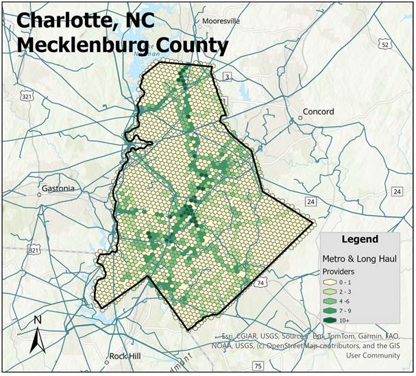
For a detailed description of H3 hexagons and the how this map was created see How to use our Data for Data Center Site Selection.
Now we turn our attention to power. Using data provided by MAPSearch, at Endeavor Business Intelligence, we can map power stations, substations, and transmission lines.
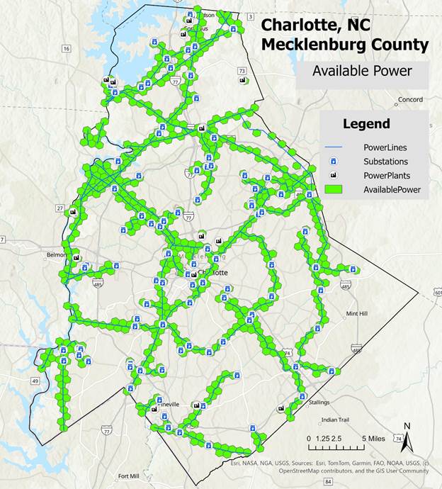
For this analysis we again used resolution 8 hexagons which have a radius of 0.33 miles. Thus, the maximum distance to any power source for a location within any hexagon is 0.66 miles.
Now that we have power mapped, we can go back to our fiber map and do an intersection of these two views to select only those hexagons that contain both fiber AND power.
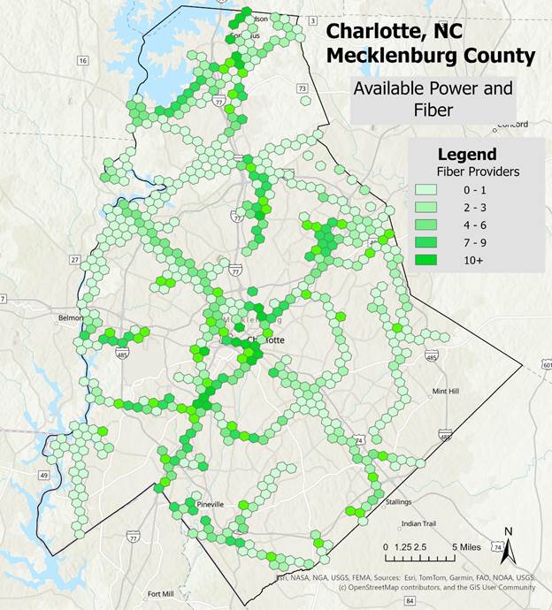
Here we can visualize where available power and fiber co-exist. In addition, the concentration of fiber that is available at these locations is preserved with the darkest green hexagons representing the greatest concentration of fiber providers. This is an ideal method for determining the optimal locations for new data center builds as we are assured of existing power along with the availability of fiber.
Zooming in to one of the dark green hexagons, I have added the longitude, latitude coordinates.
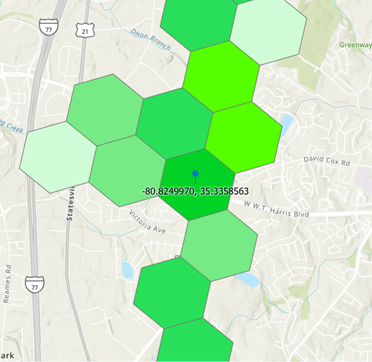
We can access the carriers to find out who is available. These include:
Arelion – North America, AT&T, Brightspeed, Lumen, MCNC, Segra, Sprint, Uniti Fiber, Windstream, and Windstream – Dark
So, there you have it. If you are interested in locating optimal sites for new data center development in the Charlotte market, this analysis should jump start your selection process. Next step is to overlay land parcels along with any other topographical features that could limit development such as flood or fire zones, zoning restrictions along with water availability.
If you would like to learn more about FiberLocator, MAPSearch, and how to integrate these data sets into your own analysis, contact us at support@fiberlocator.com.